Verified Views
Verified Views that stand up to scrutiny
Accurate Visual Representations created with survey data, calibrated photography, and a recorded methodology.
Verified Views, also known as Accurate Visual Representations, are planning-grade photomontages created from real, surveyed viewpoints. They show exactly how a proposed development will appear within its existing context, giving planning teams, local authorities, stakeholders and communities a reliable visual basis for review.
Emperor Vision combine precise photography, topographical survey data, 3D modelling, camera matching and photorealistic post-production to create views that are not simply persuasive, but verifiable.
Planning confidence
For complex or sensitive developments, visual accuracy is essential. A verified view helps establish trust by showing the true scale, massing, position, and visual impact of a proposal from agreed public viewpoints.
This can be critical when responding to planning concerns, demonstrating impact, supporting consultation material or helping decision-makers understand how a scheme will sit within its real-world surroundings.
Commercial clarity
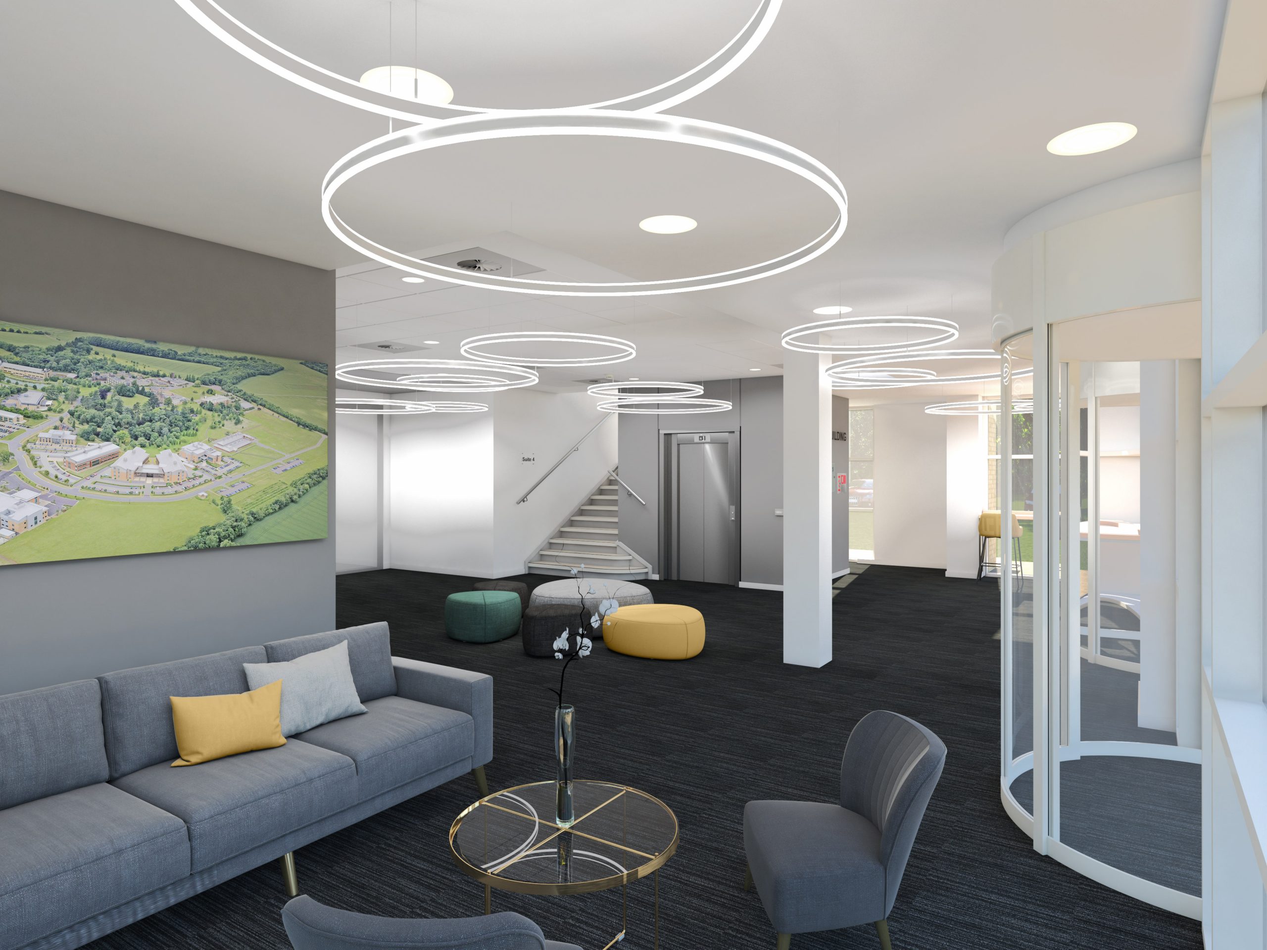
Beyond the planning process, AVRs also help clients communicate with confidence. They translate technical drawings into clear, realistic images that investors, stakeholders and local communities can immediately understand.
The result is a more informed conversation around design, visibility, impact and value, helping projects move forward with greater clarity.
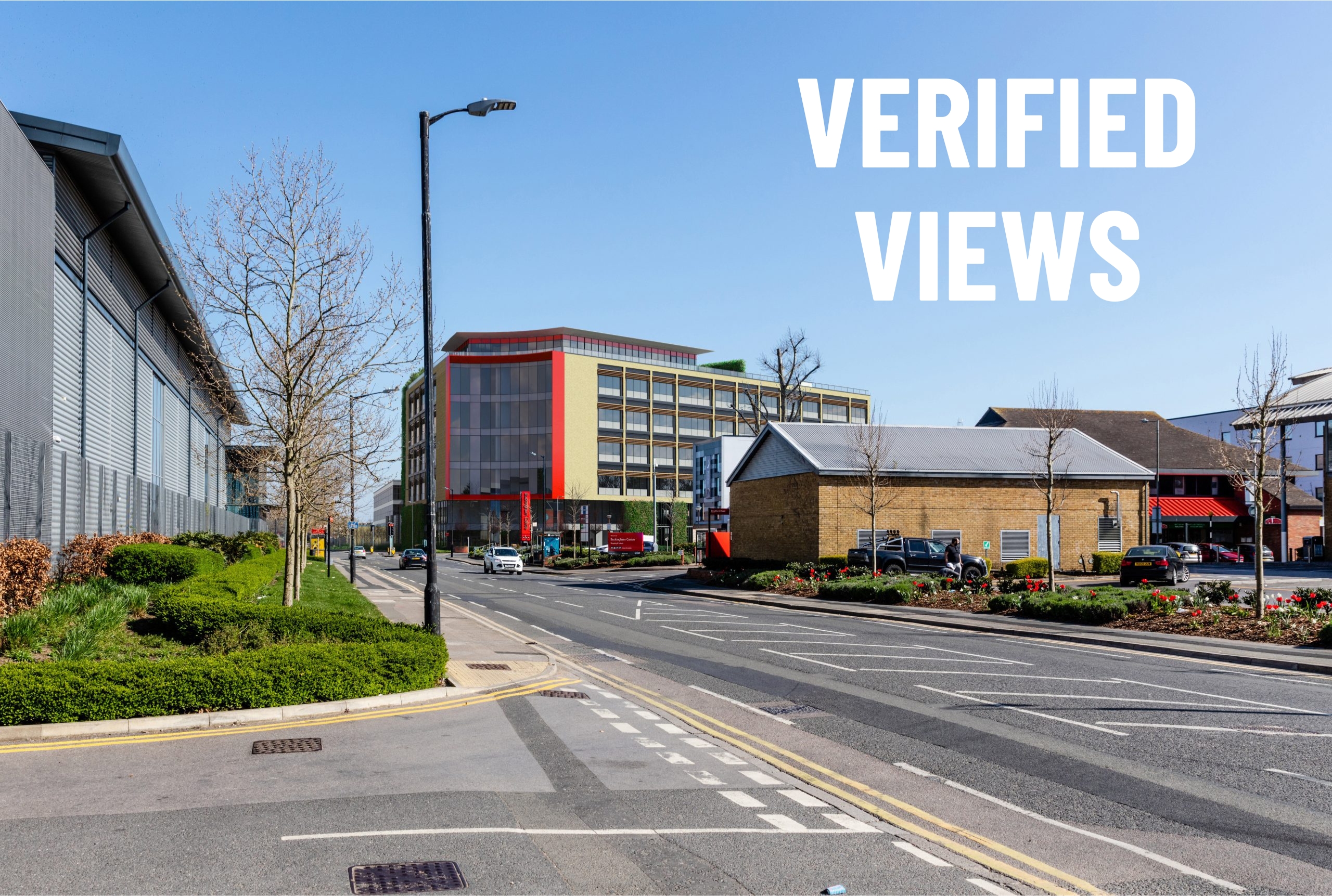
From baseline photograph to planning-grade AVR
Each view begins with a real camera position, captured and recorded on site. Survey points are then identified across the photograph and measured in three-dimensional space. These points allow a virtual camera to be created inside the 3D model so the proposed development aligns precisely with the original photography.
The final image is rendered, masked and composited into the host photograph, producing an AVR that accurately represents the location, scale, perspective and appearance of the proposed scheme.
producing property photomontages
photorealistic representation available
survey-referenced camera positions
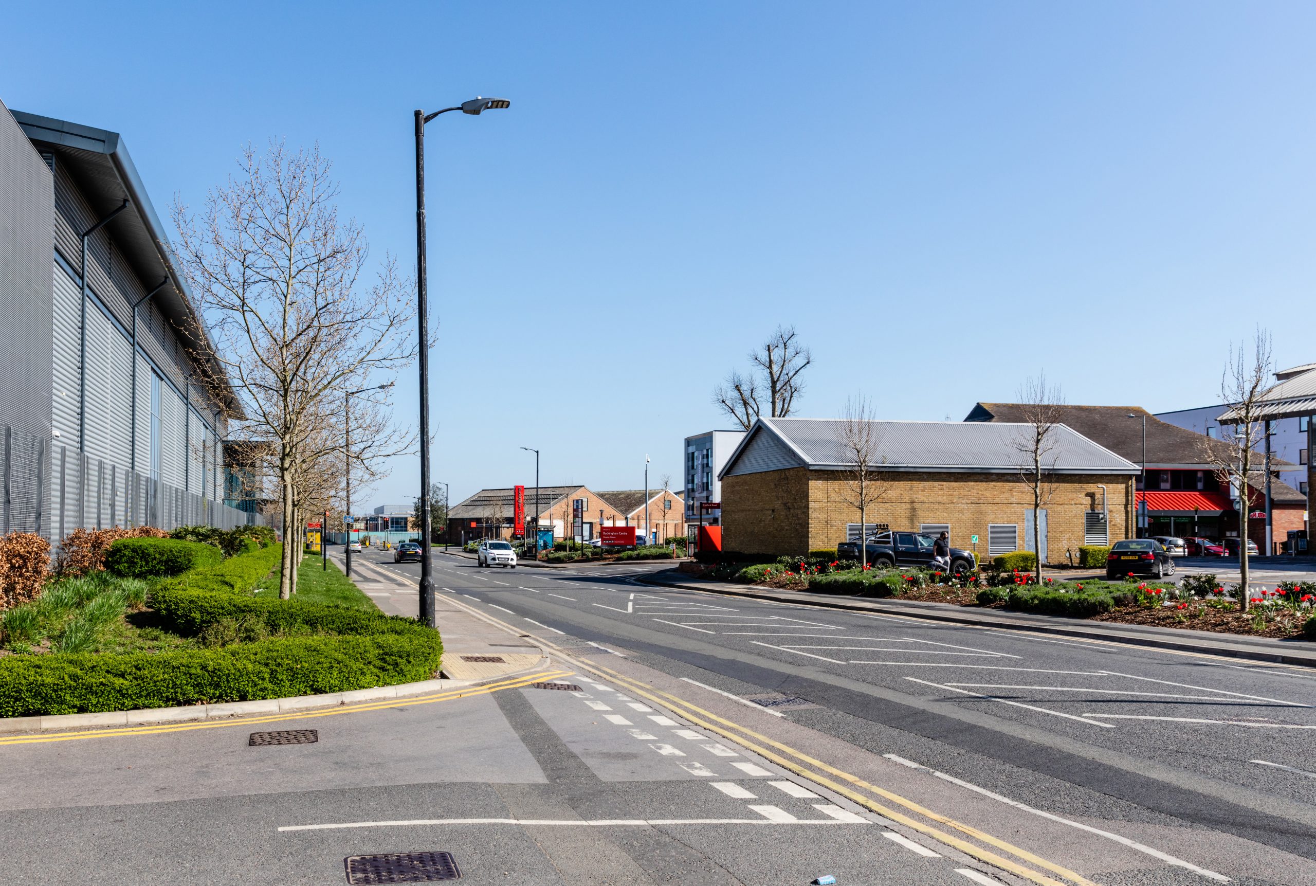
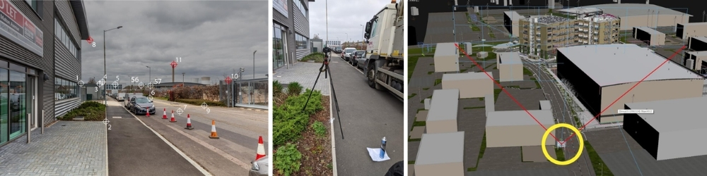
1. Viewpoint photography
High-resolution photography is captured from agreed viewpoints. Camera height, lens, direction, time, angle and position are recorded to create a robust baseline for the verified view.
2. Survey data
Key reference points visible in the photograph are surveyed and tied to Ordnance Survey coordinates, providing the measurable framework for the image.
3. Camera matching
The proposed development is built in 3D and positioned within the same survey space. A virtual camera is then matched to the real-world camera using the surveyed points.
4. Final AVR output
The model is rendered, masked and composited into the baseline photograph, creating a final image that accurately represents the proposed development in context.
Download AN EXAMPLE Methodology Statement
For planning teams, consultants and project stakeholders, Emperor Vision can provide a full methodology statement documenting the photographic, survey and modelling process behind each verified view.
This includes viewpoint records, camera data, survey references, model alignment documentation, and final AVR output information.
Need verified views for planning?
Emperor Vision produce accurate, planning-grade verified views and AVRs for architects, developers, planning consultants and property teams.
Beyond Verified Views
While verified views provide the technical accuracy required for planning submissions, they can also form the foundation of highly engaging marketing and stakeholder communication tools.
For this project, Emperor Vision combined drone photography, CGI visualisation, photo-montage techniques and verified view methodologies to create a compelling animation that illustrates the proposed development within its real-world context. By integrating accurate survey data and planning information with cinematic aerial footage, we were able to present the scheme in a way that was both visually engaging and technically robust.
The result is a powerful communication tool that helps planners, local stakeholders, prospective occupiers and investors clearly understand the scale, appearance and impact of a proposed development long before construction begins.
This project demonstrates how Emperor Vision can deliver far more than planning imagery alone, combining verified views, CGI, aerial photography, animation and film production to create a complete visualisation package tailored to each client’s objectives.